Drone technology, a revolution for plant health
Dr. John Kaminski illuminates the multifaceted uses of drone technology that are dramatically transforming approaches to plant health in the turfgrass sector
As the digital revolution unfolds, its profound impact is being felt across a range of industries. The turfgrass industry is a shining example of this transition, with drone technology and camera system advancements heralding new methodologies for plant health assessment on a depth and scale never seen before.
The sky’s the limit: Discovering the unseen potential of drones
Drones have opened up a world of possibilities. Their aerial capabilities grant us unique perspectives inaccessible through conventional means, such as cherry pickers or on-site inspections. The implications for golf courses are manifold and can greatly enhance their operation and management.
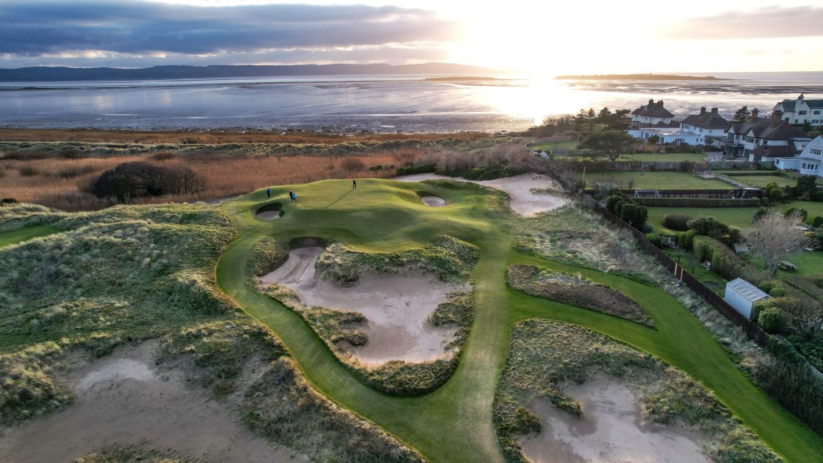
At a foundational level, drones can capture breathtaking images of your golf course, producing visually-captivating content that can be used for marketing, promotion of your facilities, or recruitment efforts for potential members and interns. In the realm of construction projects, drones offer a unique advantage, providing superior visualisations of piping arrangements or construction developments from an aerial standpoint.
Yet, the facet that genuinely kindles my interest is precision agriculture management. By harnessing the immense power of big data, machine learning and artificial intelligence, we can obtain critical insights into the health of our turf — insights that can shape decisive actions aimed at enhancing turf quality.
Demystifying drones: User-friendly software at your disposal
It’s easy to be intimidated by the technical jargon surrounding drones. However, the reality is surprisingly user-friendly. A host of free software options have streamlined the use of drones, making this advanced technology accessible and practical.
With modern camera technology, we have the power to perceive our turf in novel ways. Most of us have encountered heat maps or colour-coded diagrams that distinguish between wet and dry regions. Today’s drone-integrated camera systems can quickly map out an entire golf course on a large scale, supplying a wealth of data that can inform decision-making.
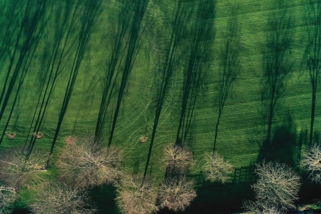
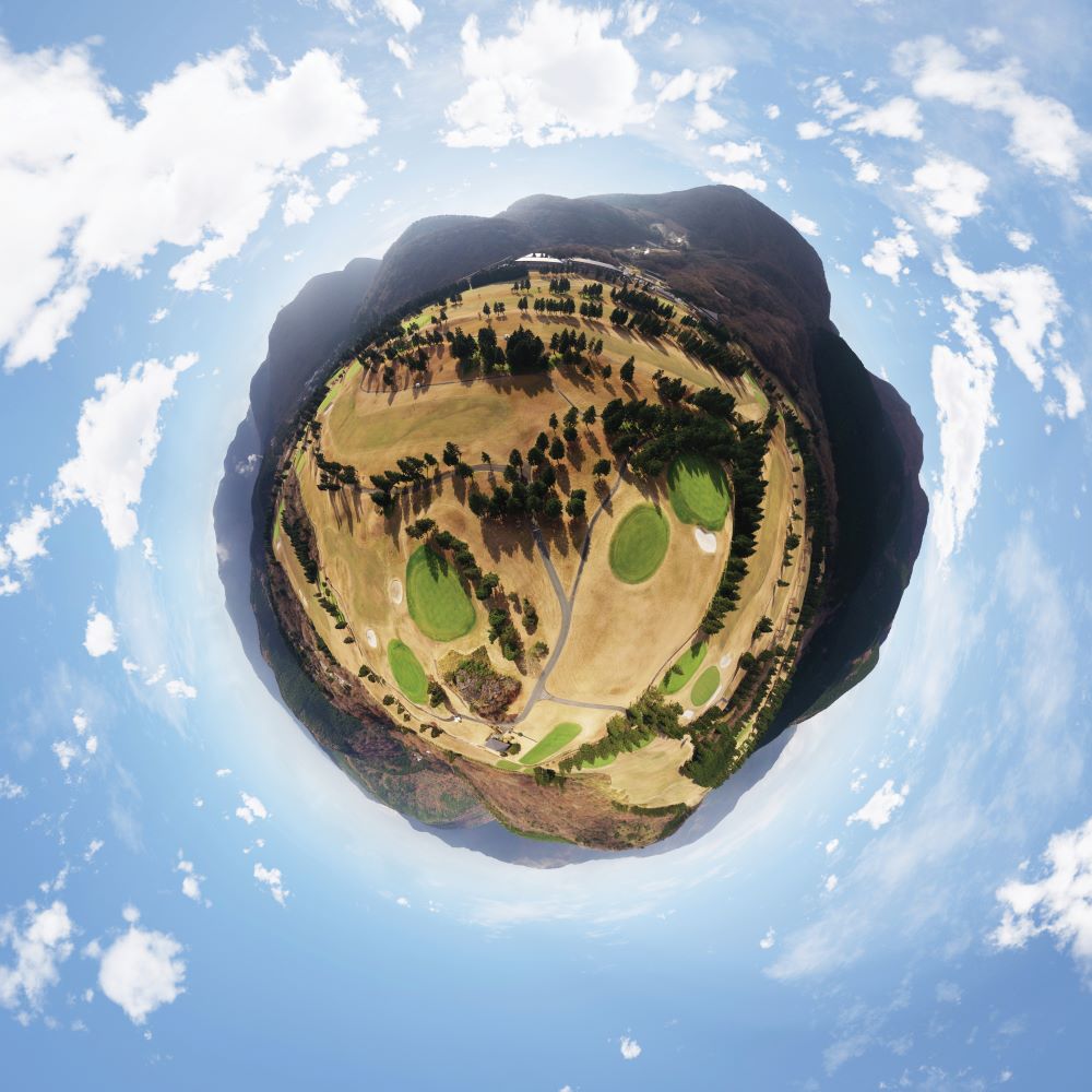
Furthermore, the stunning aerial images captured by drones serve multiple functions, aiding in shade management by mapping out sun and shade patterns throughout the year. User-friendly software like DroneDeploy simplifies the process further, seamlessly stitching together your images to generate a comprehensive map of the course, complete with interactive 3D models that can be viewed from various angles.
The regulatory framework and safety considerations
As we discuss the multifaceted applications and advantages of drone technology in turfgrass management, it’s vital not to overlook the legislative landscape surrounding drone usage. The ever-evolving regulatory framework can seem complex, but understanding and adhering to these rules is a fundamental aspect of responsible drone operation.
In the UK, drone usage is governed by the Civil Aviation Authority (CAA). They stipulate that drones weighing more than 250 grams must be registered, and drone operators must pass an online theory test to obtain a Flyer ID and an Operator ID.
From a safety perspective, there are some key points to keep in mind. Drones must always remain within the operator’s line of sight and are generally not allowed to fly above 120 metres (400 feet). Moreover, drones should not be flown within 50 metres of people, vehicles, buildings, or vessels not under the control of the person in charge of the aircraft. Beyond legal and safety aspects, it’s also important to consider privacy issues. Golf course operators should be aware of the implications of capturing images or videos in areas where individuals might have a reasonable expectation of privacy.
Equally, drone pilots should be cautious about the potential for accidents and have a contingency plan in place should the drone malfunction. This includes having an insurance policy to cover any potential damage caused by a drone accident.
A closer look: Unveiling the power of drone camera technology
Drone photography and plant health assessments predominantly utilise three types of cameras: RGB, NDVI and thermal imagery.
RGB, or Red-Green-Blue, cameras are your conventional cameras that capture images in a colour spectrum that mirrors human eye perception. They provide a clear, visual representation of the golf course’s overall condition.
Taking a step further into sophistication, we encounter NDVI, or Normalised Difference Vegetation Index. This technology measures light reflectance across various wavelengths, offering a scaled (zero to one) measure of plant health. One signifies optimal health, while zero might indicate potentially unhealthy or dead turf.
The latest addition to the camera arsenal is thermal imagery cameras. These devices measure heat, delivering invaluable data about turfgrass temperatures, impacts of irrigation, drought stress detection and more.
About Dr. John Kaminski
John is a professor and associate department head of the Department of Plant Science at Penn State University. He also serves as director of the Golf Course Turfgrass Management Program at the institution.
Vastly experienced in the field of golf course turfgrass management, he has extensive knowledge on the subject of turfgrass diseases and has been responsible for or associated with the discovery of four new diseases on golf courses.
In addition, John is responsible for mentoring aspiring golf course superintendents in his role as director of the Golf Course Turfgrass Management Program. He also serves as co-advisor for the Penn State Turf Club.
Dr Kaminski was speaking at Continue to Learn at BTME. BIGGA members can rewatch this session and other highlights from the education programme by heading to the Members’ Area of the BIGGA website.